
Sports
Jefferson, Jones and Murray all produce to help the unbeaten Vikings top the slumping Saints 23-13
By Katherine Langford
KSTP 5
Advertisement
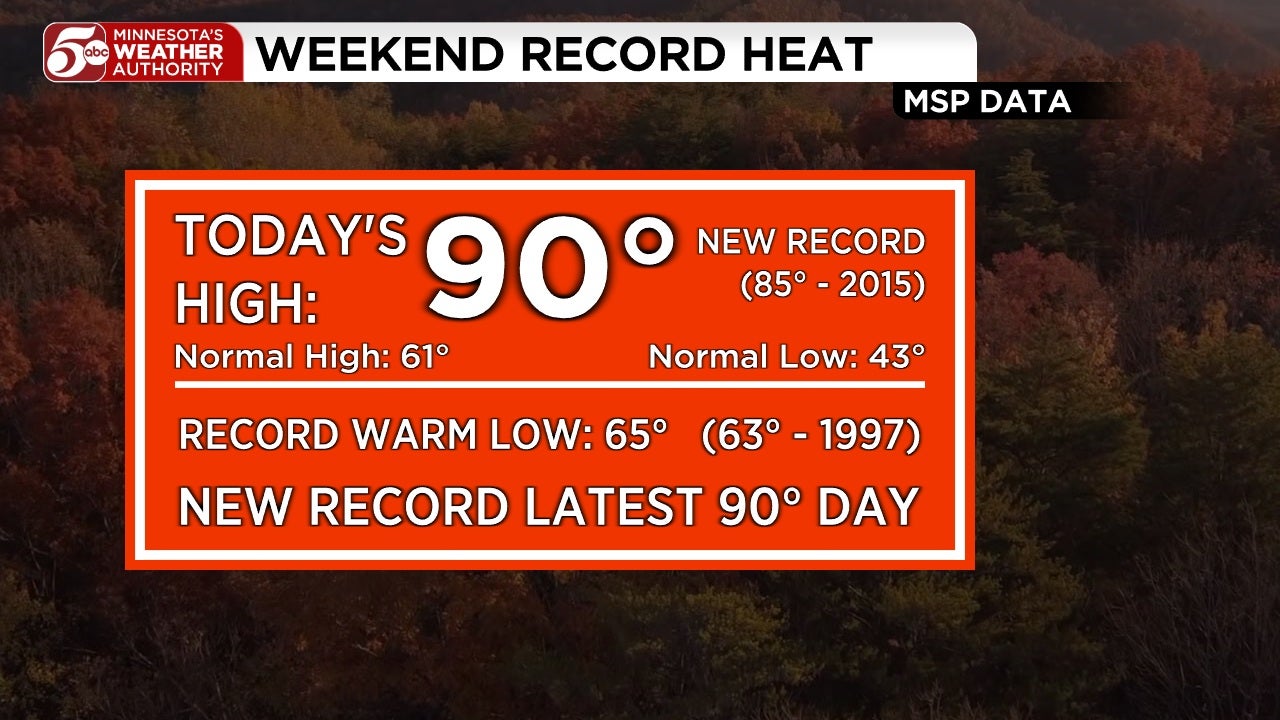
RECORD HEAT in Twin Cities, cooler this week By KSTP This weekend has been an October scorcher! First, we hit 90° on Saturday which tied the 98-year-old record latest 90-degree day. This of course tied the daily record high maximum temperature. Strong south winds and clear blue skies helped us warm up quickly.That heat stuck around into Sunday morning, with a low only reaching 65°. This was a record high minimum temperature, breaking the old record of 63° from 1997.From that warm start, we soared once again to 90° in the afternoon, a new record high maximum (previously 85° in 2015). This of course breaks the record latest 90-degree day set yesterday! Similar amounts of sunshine and a slightly gentler south breeze helped us warm up fast again today.We won’t get rid of all this heat in one night, and we’re forecasting yet another record high minimum temperature tomorrow morning. The existing record is 63° set in 1997, and our team’s forecast for tomorrow morning is 65°.Notice I’ve specified “minimum” and “maximum” temperatures. When talking about heat records, a high/low record can apply both for the coolest morning temperature and warmest afternoon temperature. So we can lump together record “highs” for minimum and maximum temperatures, as well as record “lows” for an individual year.For the Twin Cities in 2026, we have set or tied 7 record high min/max temps; on the other hand, we have not had a single record low temperature.Other records around the area:SaturdaySt Cloud – 90° (88° – 1928)Sunday:St Cloud – 85° (83° – 2015)Eau Claire – 88° (85° – 1930)ForecastMonday afternoon we’re looking at another high in the low 80s and upper 70s. It will be dependent on how quickly the cold front advances. Shower chances remain to the North, but the Twin Cities will likely stay dry.Tuesday we have a significant drop, with highs falling 20 degrees. We’ll see highs remain in the low 60s into Wednesday as well with lows dropping into the 40s.Late week, highs slip further down into the upper 50s as we get rain returning to most of the state Thursday. Behind that rain a cooler airmass moves in for Friday with highs in the mid 50s.Overnight into Saturday morning, we’re starting to see the first indications of a frost potentially reaching the Twin Cities, with our first low in the mid-30s of the season. We’ll quickly warm up Saturday into Sunday.
By Katherine Langford
KSTP 5

By Katherine Langford
FOX 9

By Marcus Chen
WCCO / CBS Minnesota

By Katherine Langford
FOX 9